Why Aruba Is a Desert (And Where to Find Green Patches)
Why Aruba Is a Desert (And Where to Find Green Patches)
Aruba can feel like a small Caribbean plot twist. You arrive expecting palms, wet forest and the sort of greenery that seems to swallow a road, then drive inland and find cactus-covered hills, pale limestone, dusty tracks and trees leaning as though someone has been pushing them sideways for years. Around Guadirikiri Cave, this dry character is especially obvious. The cave sits inside Arikok National Park, where the landscape is shaped by scarce rainfall, strong trade winds and plants that have learned to make a little water go a very long way.
Calling Aruba a desert is useful shorthand, but geographically the island has a tropical semi-arid climate rather than a classic hot desert. The distinction matters if you are planning a visit to Guadirikiri Cave because the scenery outside the cave is not rainforest scenery waiting to surprise you. Expect sun-baked rock, cactus, scrub and open ground, with small green pockets appearing when rain gives the island a drink.
Aruba Tourism Authority describes the island as tropical and semi-arid, with average temperatures generally around the low to upper 80s °F (roughly 27–32°C) and only modest rainfall. Its current climate guide puts average annual rainfall at about 18 inches, with October through December forming the modest rainy season. A separate Aruba Tourism Authority page gives a slightly lower long-term figure of about 16 inches, so I treat the rainfall number as approximate rather than pretending a tiny island keeps one perfectly tidy weather ledger.
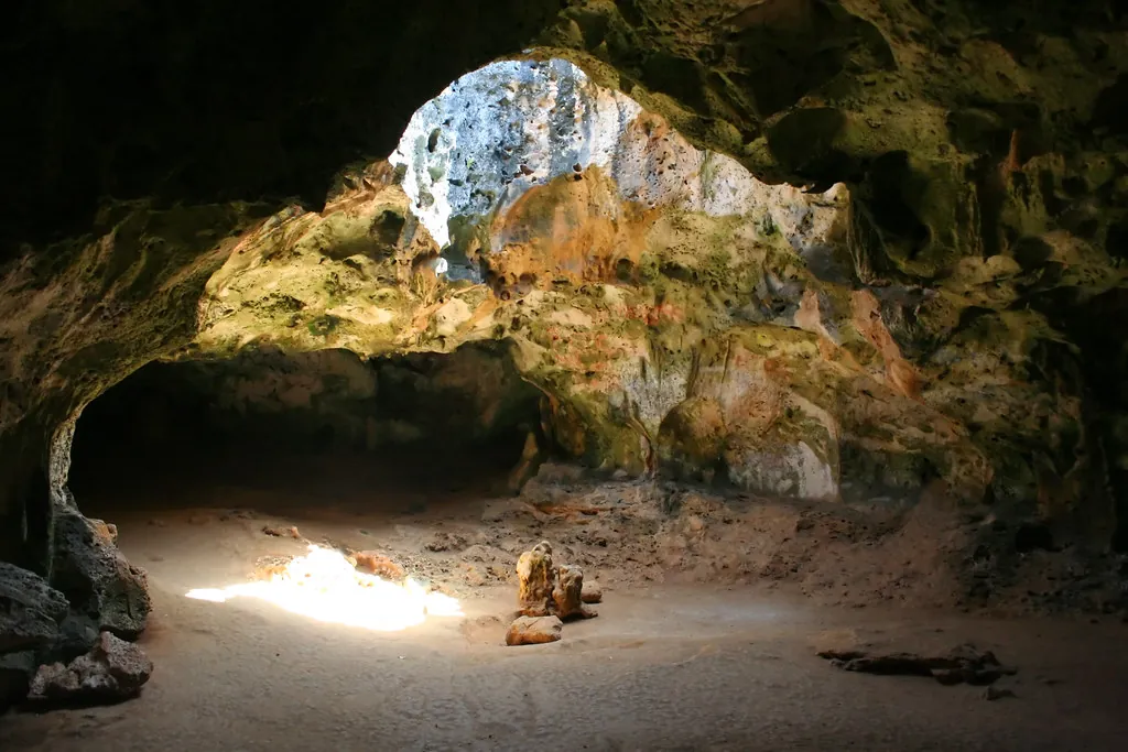
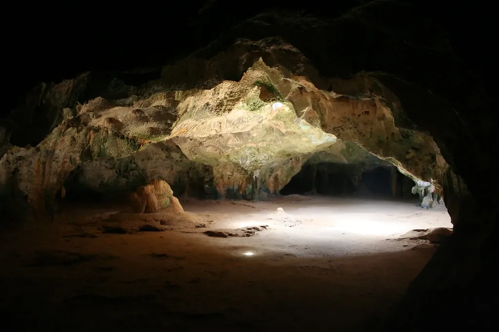
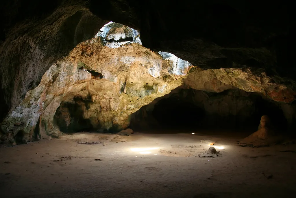
That dry background is part of the reason Guadirikiri Cave feels so dramatic. Outside, sunlight hits pale rock and thorny vegetation; inside, the chambers drop into proper dark, with shafts of daylight entering through openings in the limestone roof. The contrast is wonderfully stark, and it makes more sense once you understand the island around it.
Guadirikiri makes more sense when you stop expecting a jungle island and start reading Aruba as a dry Caribbean landscape shaped by wind, limestone and short bursts of rain.
The climate numbers behind Aruba’s dry landscape
Warm most of the year
Aruba stays warm throughout the year, with temperatures generally sitting in the 80s °F. The island’s position in the southern Caribbean helps keep the climate remarkably steady, so a visit to Arikok rarely feels like a seasonal change from one completely different ecosystem to another.
Rain comes in short spells
The rainy season is modest rather than monsoonal. October to December sees the greatest likelihood of rainfall, yet showers can be brief, leaving long stretches of sunshine between them. After a good spell of rain, the dry landscape can change colour surprisingly quickly.
Aruba climate snapshot
| Climate Detail | Current Aruba Guidance |
|---|---|
| Climate type | Tropical semi-arid (desert / xerophytic scrub) |
| Average annual rainfall | About 16–18 inches (400–450 mm) |
| Typical temperatures | 80–90°F (27–32°C) year-round |
| Modest rainy season | October to December (sporadic short showers) |
| Trade winds | Persistent easterly trade winds (strongest May–October) |
| Hurricane position | South of the main Atlantic hurricane belt |
For the official figures and seasonal details, check the Aruba Tourism Authority’s Weather and Climate guide before travelling, particularly if you are planning long walks in Arikok.
Why Aruba stays dry
Geography gives the story its opening chapter. Aruba sits in the southern Caribbean, only around 15 to 18 miles north of Venezuela’s Paraguaná peninsula, and belongs to the Leeward Antilles with Curaçao and Bonaire. It sits well south of the main Atlantic hurricane belt, in a part of the Caribbean known for steady warmth and persistent easterly trade winds.
Those winds matter because they continually move air across the island. They are not a magic switch that simply removes rainfall, and it would be misleading to pin Aruba’s dryness on one mechanism. The island’s location, atmospheric circulation and limited precipitation work together to create the semi-arid conditions you see on the ground.
Walk around Arikok and the result is written into almost every plant. Leaves tend to be smaller or tougher, roots and stems are adapted to irregular water supplies, and cactus becomes a perfectly sensible neighbour rather than an exotic curiosity. The landscape can look sparse from a distance, yet closer inspection reveals plenty of life tucked between rocks and beneath thorny branches.
The Aruba Tourism Authority’s geographical guide is useful background if you want to see how the island’s southern Caribbean position fits into the wider region.
What “desert” means in Aruba
Aruba’s desert character is a description of landscape and climate, not a claim that the island is a classic continental desert. There are no enormous dune seas stretching to a distant horizon around Guadirikiri. Instead, the dry environment is a mixture of rocky hills, thorny scrub, cactus, limestone, sandy areas and vegetation adapted to limited rainfall.
You will also hear landscape words that carry a distinctly Aruban flavour. Mondi is used for rural or backcountry areas, while cunucu refers to countryside and dry agricultural land. These words help explain why the island’s interior can feel so different from the resort districts along the coast. The landscape is not empty space between beaches. It has its own vocabulary, history and working relationship with water.
The cactus country around Arikok
Arikok National Park is the place where Aruba’s dry ecology becomes impossible to miss. The park covers roughly 20 percent of the island and contains cactus-covered hills, rocky terrain, limestone formations, caves and exposed coastal landscapes. Guadirikiri Cave sits within this larger protected environment, so the cave visit is really a short chapter in a much bigger natural story.
Prickly pear cactus, agave and aloe are among the plants associated with Aruba’s arid conditions. They are not decorative extras placed around a tourist attraction; they are working parts of an ecosystem that has to cope with heat, wind and irregular rain. Some cactus species store water, while other drought-adapted plants reduce water loss through their structure and growth habits.
- Prickly pear: recognisable by its flat pads and edible fruit, with colour appearing when conditions suit the plant.
- Agave: a tough, drought-adapted plant with thick leaves arranged in a strong rosette.
- Aloe vera: one of the plants strongly associated with Aruba’s dry flora, with fleshy leaves adapted to storing moisture.
- Native and naturalised scrub: low vegetation fills gaps between rocks where enough soil and moisture collect.
Arikok’s protected status matters here. The Aruba Tourism Authority’s Arikok National Park guide describes the park as home to a wide range of plant and animal life, with its conservation work tied to the protection of the island’s natural and cultural heritage.
If you are walking beyond the cave entrance, treat cactus country as real habitat rather than scenery designed for touching. Closed shoes are a sensible bit of kit, especially on uneven ground where a misplaced foot can meet a very unfriendly plant.
Divi-divi and fofoti: Aruba’s wind-shaped trees
Divi-divi, or watapana
The divi-divi, also called watapana, is one of Aruba’s most recognisable trees. Its trunk and branches develop a strongly leaning form under the island’s persistent trade winds, giving the tree an almost permanently windswept posture.
That familiar silhouette is more than a postcard motif. It is a visible record of the prevailing wind, written slowly into wood.
Fofoti near the coast
Fofoti trees are another wind-shaped feature of Aruba’s landscape, particularly associated with coastal environments. Their twisted appearance can resemble the divi-divi from a distance, although they are different trees.
Near rocky shores, these trees add a useful clue to how exposed the island can be. The wind is not background decoration here. It is part of the physical environment.
Aruba’s trees can look as though they have been caught mid-stride. Spend a few minutes watching the branches before you photograph them, and the direction of the wind becomes surprisingly obvious.
The Aruba Tourism Authority’s flora and fauna guide explains the characteristic forms of both divi-divi and fofoti trees, alongside the cactus and aloe that define much of the island’s dry vegetation.
Arikok National Park is where the landscape makes sense
Arikok covers roughly one-fifth of Aruba, which gives you a remarkably large slice of the island in which to read this environment. Its terrain includes cactus-covered hills, limestone formations, rugged coast, caves and dry river beds. The park’s Guadirikiri and Fontein caves are two very different ways into the island’s geology and cultural history.
Guadirikiri is particularly memorable because the cave’s interior creates such a strong contrast with the ground outside. You leave the bright, wind-washed landscape and enter a cooler space where limestone walls catch only fragments of daylight. Openings in the ceiling let sunlight fall into the chambers, making the cave feel almost cathedral-like for a few minutes, although the geology is considerably older and less polite than any church I have visited.
For a wider route through the park, use our Arikok National Park & Nearby Caves guide. It puts Guadirikiri alongside Fontein Cave, the Natural Pool and other park stops without treating the whole place as a single attraction.
Where Aruba gets unexpectedly green
Dry does not mean lifeless. Aruba’s greener moments tend to appear where water collects, where wind exposure is lower, or after enough rain has fallen to wake dormant growth. A shallow depression in the ground can hold moisture for longer than the surrounding rock, and a sheltered pocket can look surprisingly leafy beside an exposed hillside.
The most noticeable change often comes during the October to December rainy season. Rain can arrive in short showers, then disappear behind a return of bright sunshine. Given a decent spell of precipitation, plants respond quickly, and landscapes that looked beige or grey can develop a fresh green cast.
- After seasonal rain: low vegetation can green up across rocky ground, particularly where soil holds moisture.
- Sheltered pockets: vegetation may look denser in protected hollows and areas less exposed to the trade winds.
- Seasonal flowers: plants such as wanglo and flowering prickly pear can add flashes of colour when conditions are right.
- Coastal vegetation: some protected coastal areas can feel greener than the exposed interior, especially where plants have access to moisture.
None of this turns Arikok into a jungle. If you arrive after seeing photographs of lush Caribbean islands and expect dense forest around Guadirikiri, the landscape may surprise you. That surprise is part of the point. Aruba’s beauty is tied to what grows here despite the limited rainfall, not to a rainforest that does not exist.
For seasonal timing, our Best Time to Visit Guadirikiri Cave guide covers rainfall, heat, sunlight inside the cave and the conditions that matter for photography.
What the landscape around Guadirikiri Cave actually feels like
The approach to Guadirikiri is much closer to a dry rocky landscape than a tropical forest walk. Expect strong sunlight, exposed ground and cactus country around the park. The cave then changes the sensory experience almost immediately: outside noise fades, the light becomes a thin beam or a soft reflection on limestone, and the darker sections can feel humid and enclosed.
This contrast is one reason the cave photographs so well. A camera can struggle with the jump between brilliant exterior light and deep interior shadow, so exposure for the darker chamber rather than the bright entrance. If you are using a phone, tap the cave wall or darker section of the frame before taking the photograph, then hold the device steady for a moment longer than feels necessary.
The roof openings are the stars of the composition when sunlight reaches them. A little patience helps because the beam changes as the sun moves. For detailed cave photography, our Guadirikiri Cave Photos & Chambers guide goes deeper into composition and low-light settings.
There is wildlife here too, including bats, so keep voices down and avoid using flash around them. A torch or phone light is much kinder than blasting a dark chamber with repeated flashes. Our Aruba Cave Etiquette guide covers responsible behaviour around bats and cave formations.
Why the trade wind can fool you about the heat
One of Aruba’s great little tricks is that the wind makes hot weather feel manageable. You can stand in a steady breeze, feel perfectly comfortable, and forget that you are still walking under strong Caribbean sun. The result can be a surprisingly dry mouth and a headache arriving with the subtlety of a tax bill.
- Carry more water than you think you need for an exposed walk.
- Use sunscreen and reapply it during longer outdoor outings.
- Wear closed-toe shoes with grip for rocky paths and cactus country.
- Take a hat or other shade from the direct sun.
- Keep the cave visit within a broader plan that leaves room for shade and recovery.
- Respect marked routes, park instructions and temporary closures.
The Aruba Tourism Authority also notes that tap water on the island meets high quality standards, so you do not need to treat hydration as a complicated expedition. A refillable bottle is the sensible companion, and the trade wind is no substitute for drinking regularly.
Green Aruba beyond Arikok
If you want to see Aruba’s greener side, look for places where water and shelter interrupt the island’s usual dryness rather than searching for a jungle. Wetlands, gardens, sheltered coastal vegetation and rain-fed pockets can all look markedly greener than an exposed hill in Arikok.
The contrast is especially useful if you are spending several days on the island. A beach morning can give you the familiar postcard version of Aruba, while an afternoon in Arikok shows the dry interior, and a rain shower can briefly repaint parts of that landscape. The island keeps changing texture without changing its underlying character.
For a broader nature itinerary, start with our Arikok National Park & Nearby Caves hub, then use the Arikok National Park Packing List & Desert Safety guide before heading inland.
Reading Aruba’s landscape before you explore it
Once you understand the climate, the cactus stops looking like a novelty and starts looking like evidence. The divi-divi tells you about the wind. The sparse scrub tells you about water. The limestone around Guadirikiri tells a much older geological story, while the sudden green after rain reminds you that semi-arid does not mean sterile.
That is the useful way to approach Guadirikiri Cave. Come for the roof openings and the strange beauty of the chambers, but give the landscape outside a little attention too. The dry ground, leaning trees and cactus are part of the cave experience because they explain the world into which the cave opens.
Bring better shoes than your holiday sandals, drink water before you feel thirsty, and give the cactus country a proper look. Aruba’s dry side rewards attention.
Official Aruba resources
- Aruba Tourism Authority: Weather and Climate, for rainfall, temperature and seasonal weather information.
- Aruba Tourism Authority: Aruba’s Flora and Fauna, for information about cactus, aloe, agave, divi-divi and fofoti.
- Aruba Tourism Authority: Is Aruba a Desert?, for the island’s semi-arid landscape and desert terminology.
- Aruba Tourism Authority: Where Is Aruba?, for the island’s geography and southern Caribbean location.
- Aruba Tourism Authority: Arikok National Park, for current park information and natural attractions.
Guadirikiri Cave makes the most sense as part of Arikok’s wider landscape. The cave is dark where Aruba is bright, cool where the open ground is sunlit, and quiet beneath a roof pierced by natural openings. Outside, the island keeps doing what it has done for generations: conserving water, leaning into the trade wind and waiting for the next useful shower.
When you are ready to put the geology and desert scenery together, start with our practical Arikok National Park & Nearby Caves guide, then check How to Get to Guadirikiri Cave for the journey into the park. If you are building a full cave day, the Fontein Cave vs Guadirikiri comparison helps put the two famous Arikok caves in context.